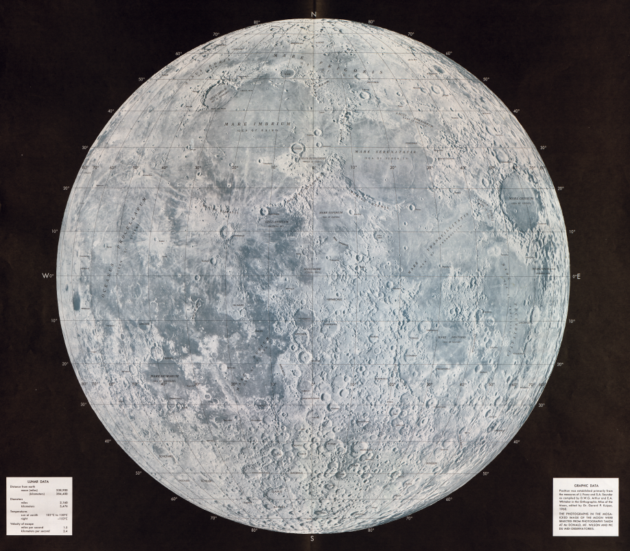
The 1962 map of the moon. The Sea of Tranquility, where the Apollo 11 mission landed, is the large dark area at center right, Geography and Map Division.
Cynthia Smith, a reference specialist in the Geography and Map Division, wrote a short piece about this lunar map for the Library of Congress Magazine. It’s been expanded here.
The Soviet Union demonstrated its early lead in the Cold War space race with the United States with the launch of the satellite Sputnik 1 in 1957. They continued to develop their space program and, in April 1961, Soviet cosmonaut Yuri Gagarin became the first human to orbit the Earth.
The orbit was a dicey proposition. Nearly half of Soviet rocket launches had failed. A launch pad explosion in 1960 had killed dozens of people, perhaps more than 1o0. Somehow, Gagarin was preternaturally calm on April 12, the morning of his launch. His pulse rate was just 64 a few minutes before liftoff. Then the rockets kicked in on Vostok 1, his ship, sending him just beyond the Earth’s atmosphere.
His single orbit took just under two hours. It was not a good ride. He thought he was going to burn to death during reentry. He could seem flames licking the outside of his ship. “I’m burning,” he told ground control. “Goodbye, comrades.”
The flames were just burning plasma, though. Gagarin’s capsule spun wildly, the result of coming in too fast, nearly causing him to black out. But he managed to eject from the capsule, as planned, at about 23,000 feet, still in his space suit, and land safely in a field in the Saratov Oblast, near the Volga River.
He instantly became a Soviet hero and an international celebrity.
Nowhere outside of the Soviet Union did his name resonate more than in the United States, where space flight was in its infancy. So galling was Gagarin’s success that President John F. Kennedy went before a joint session of Congress a month later, laying out an astonishing goal: The U.S. would put astronauts on the moon by the end of the decade, he said.
That speech set off one of the most ambitious American scientific projects of the 20th century. Early on, the mission needed a detailed map of the moon, to see where this proposed flight might land. To that end, the Aeronautical Chart and Information Center of the U.S. Air Force compiled the above lunar photo mosaic map in November 1962, using remote sensing imagery. Scientists and photographers had drawn and photographed the moon, dating back to the 17th century. But this was a project that needed a cartographer’s scientific skillset, as the National Geo Spatial–Intelligence Agency (the ACIC’s descendant) points out in a post about their work on the mission.
“Accurate coordinates of the sites needed to be determined in a coordinate system consistent with accurate vehicle orbit information,” said John Unruh, a former ACIC cartographer and scientist. The agency would go on to create hundreds of maps for the Apollo missions, including 3-D plastic models of the moon’s surface at proposed landing sites.
The following years were dangerous ones for both nation’s space programs.
On Jan. 27, 1967, three U.S. astronauts — Gus Grissom, Edward White II and Roger B. Chaffee — were killed when their Apollo 1 capsule caught fire during a training exercise at Cape Canaveral, Florida.
Three months later, Soviet cosmonaut Vladimir Komarov was killed during an orbiting mission in a very flawed spaceship. His capsule hurtled back to Earth, its parachutes failing to open, killing him on impact. Intercepted radio communications showed that, as the module fell, he was screaming in rage at Soviet space officials for sending him on a doomed mission. Then, on March 27, 1968, Gagarin himself was killed in a training jet exercise.
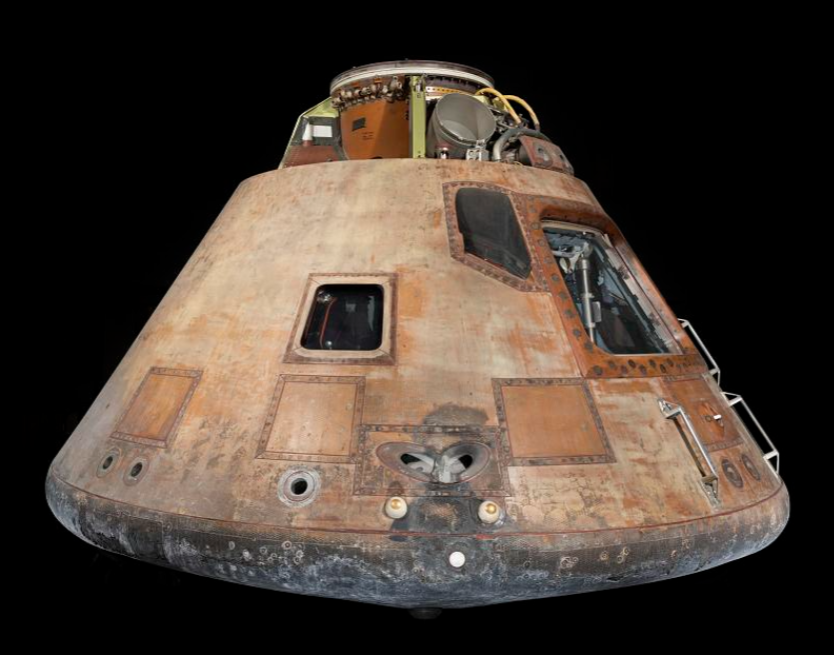
The Apollo 11 Command Module. Photo: Smithsonian Institution.
Still, less than 16 months later, on July 20, 1969, Apollo 11 astronauts Neil Armstrong and Buzz Aldrin became the first humans to land on the moon — an achievement once considered impossible and a demonstration of the United States’ now commanding lead in the space race. The landing module was put down in the Sea of Tranquility, a flat plain of dark lava that is roughly 700 kilometers in diameter. You can see it on the map above, just to the right of the middle center, as a broad, darker section that extends at a downward angle. It is to the left of the large round crater at center right.
It was there, with the help of a map made 238,900 miles away, that Armstrong took his “one small step” that was a “giant leap” for mankind.
Subscribe to the blog— it’s free! — and the largest library in world history will send cool stories straight to your inbox.