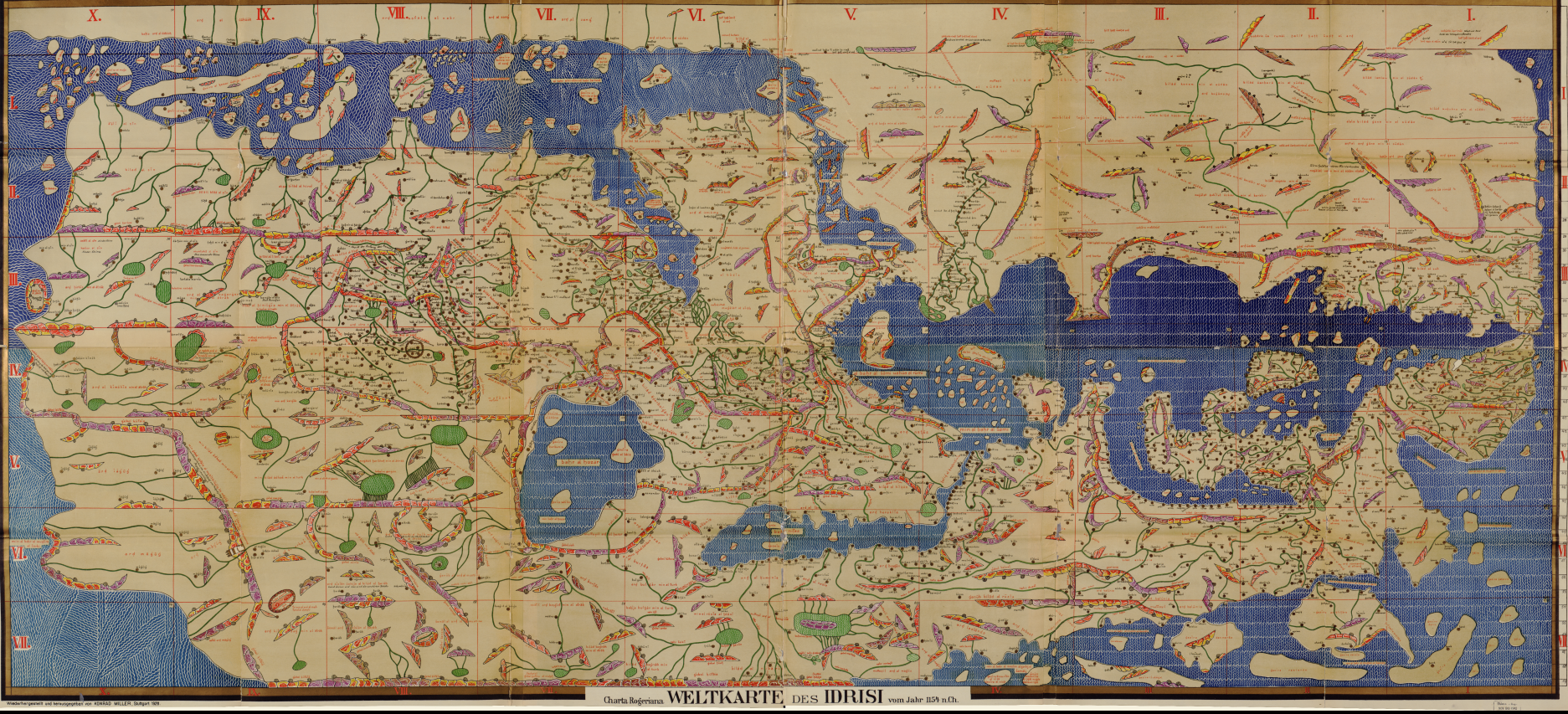
The world map of al-Idrisi in 1154. It’s upside down from the modern point of view — the south at the top, north at the bottom — and Mecca at the center top. Facsimile by Konrad Miller, 1928. Geography and Map Division.
This is a guest post by Sundeep Mahendra, head of the Research Access and Collection Development Section in the Geography and Map Division.
Early in the 12th century, King Roger II of Sicily commissioned Arab Muslim geographer and cartographer Abu Abdallah Muhammad ibn Muhammad ibn Abdallah ibn Idrīs al-sharif al-Idrīsī (or al-Idrisi) to produce a book detailing the geography of the known world.
Over the course of nine years, and drawing on earlier works by Ptolemy, Arabic sources, firsthand information from world travelers and his own experience, al-Idrisi in 1154 completed what became one of the most detailed geographical works created during the medieval period.
Consisting of 70 separate section maps with accompanying text, when put together the original sheets would have created a rectangular map 9 feet, 5 inches long. In 1928, Konrad Miller produced this re-creation of al-Idrisi’s original work.
To a modern viewer acclimated to north being placed at the top of a map, this view of the world may seem skewed or even upside down. However, orienting maps with the south at the top was a common practice in Islamic cartography. Viewed from this direction, Mecca, the most holy city in the Islamic world and its focal point, is at the top and most prominent section of the map.
Subscribe to the blog— it’s free! — and the largest library in world history will send cool stories straight to your inbox